
Tech giant Google is set to introduce a batch of new updates and AI features for the Google Maps app to enhance its navigation experience.
Four of the updates, to roll out this week, are expected to make navigation and exploration even more seamless and engaging. To bring more accurate search results for users, Google is merging the navigation platform with AI, pairing search results with images posted by users of places.
More engaging apps
VP and general manager of Geo at Google, Chris Philips, made the announcement on Thursday about the new features, which include Lens in Maps, Immersive View for Routes, and “more detailed mapping for drivers.”
“Google Maps is transforming how people explore and navigate, and AI continues to play a pivotal role in how we’re building innovative experiences for people around the world,” said Philips in a blog post.
According to the company, search results can now bring images that are related to the search term, based on the loads of images shared by the Google Maps community, “all done with AI and advanced image recognition models.”
“Now, when you search in Maps for specific things like the best place to find “animal latte art” or “pumpkin patch with my dog,” you’ll get photo-first results of what you’re looking for,” said Philips.
Google will release these features starting with Germany, Japan, France, the UK, and the US, while other countries will follow with time.
Also read: ByteDance Refutes Claims of Shutting Down VR Business
The updated features
Some of the features coming to Google Maps are the Expanded Lens (formerly Search with Live View). Google is expanding its Lens feature to more than 50 new cities like Austin, Las Vegas, Rome, São Paulo, and Taipei.
Lens combines augmented reality and AI to help users better understand their surroundings and navigate with precision. It provides real-time visual cues to guide users along the correct path.
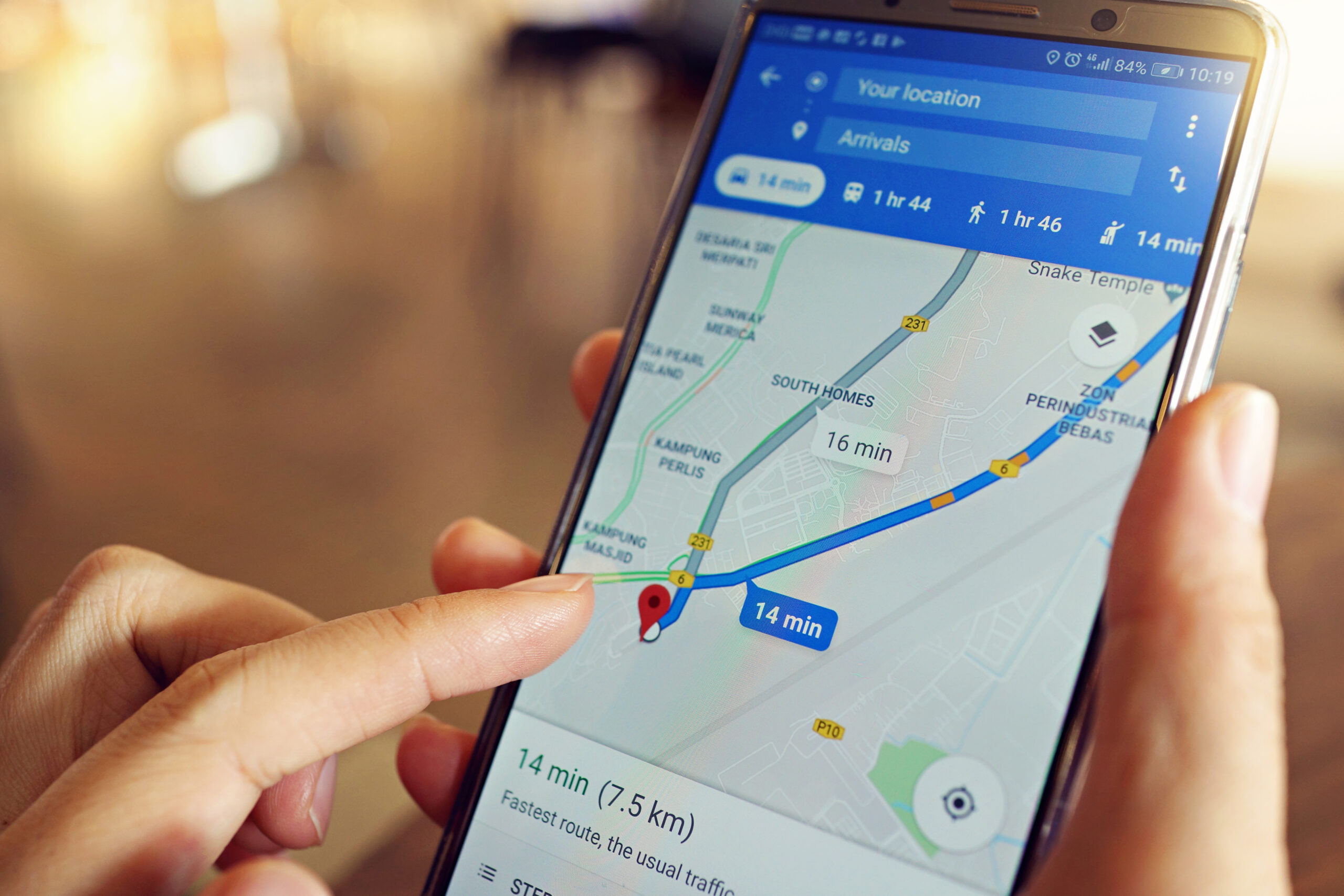
Google is also rolling out Immersive View, which will allow users to preview their route before they go on a drive. According to the company, it helps drivers plan their routes with greater precision and confidence.
Immersive View is now available in cities such as Amsterdam, Barcelona, Dublin, Florence, Las Vegas, London, Los Angeles, Miami, New York, Paris, San Francisco, San Jose, Seattle, Tokyo, and Venice on both Android and iOS platforms. Google first announced the Immersive View for routes earlier this year.
The AI-updated Google Maps will display information on electric vehicle (EV) charging stations, and details about the charging stations will be available to EV drivers using iOS and Android devices. This will provide information on compatibility, charging rates, and the state of the charging stations’ operations.
More detailed maps
According to Google, navigation maps will be updated with more details in the coming months, details meant to enhance driver safety on the roads. With this update, the company seeks to give a more accurate depiction of colors and buildings, making it easier for drivers to orient themselves.
Additionally, it will offer enhanced lane details, helping drivers plan safe and efficient lane changes, particularly on highways. Other features include providing data on high-occupancy vehicle (HOV) lanes in the US.
This update is expected to first roll out in 12 countries, like the US, Canada, France, and Germany.
Google is also introducing speed limit data to 20 more countries in Europe, and these updates are rolling out for Android, iOS, and cars with Google built-in.


 and then